'Wear on Earth' is one of our new teaching sequences for AC V9
- On the 'Sequence overview' tab you'll find all the lessons in this sequence and curriculum alignment.
- The 'Our design decisions' tab shows how key scientific ideas develop over the sequence, and shows how the sequence addresses curriculum achievement standards.
- The 'Preparing for this sequence' tab guides you through important information and considerations for this sequence.
- Have you taught this sequence? Use the Feedback button to let us know how it went!
Launch
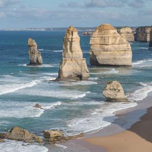
Lesson 1 • Earth’s shifting surface
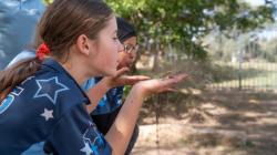
Students are introduced to the core concepts of weathering and erosion, and look for evidence of weathering and erosion in the local area with the aim of identifying a local issue that needs to be addressed.
Inquire
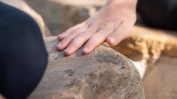
Lesson 2 • Physical weathering of rocks
Students use models to investigate the physical weathering of rocks, including a simulation of what happens when rocks are tumbled around in a river.
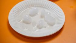
Lesson 3 • Freeze-thaw weathering
Students investigate what happens to water when it is frozen, and determine how this might contribute to the weathering of rocks.
Lesson 4 • Chemical weathering
Students explore chemical weathering through a series of hands-on investigations.

Lesson 5 • Erosion caused by wind
Students explore how wind transports sediment from one place to another.
Lesson 6 • Erosion caused by water
Students explore how water erosion can change the landscape, transporting sediment from one place to another.

Lesson 7 • Time scales and human impact
Students consolidate their understanding of weathering and erosion and consider the impact of humans on the varying time scales involved.
Act
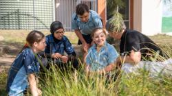
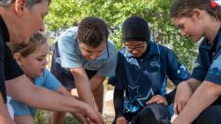
Lesson 8 • Designing an erosion control strategy
In this lesson students consolidate their learning by designing (and possibly testing) an erosion control strategy for an area of need in their school/local environment. This lesson may need to take place over several sessions.
The Australian Academy of Science supports and encourages broad use of its material. Unless indicated below, copyright material available on this website is licensed under a Creative Commons Attribution-NonCommercial-ShareAlike 4.0 International (CC BY-NC-SA 4.0) licence.
Curriculum and syllabus alignment
Year 5
By the end of Year 5 students describe key processes that change Earth’s surface. They describe examples of collaboration leading to advances in science, and scientific knowledge that has changed over time. They identify examples where scientific knowledge informs the actions of individuals and communities.
Students plan safe investigations to identify patterns and relationships and make reasoned predictions. They identify risks associated with investigations and key intercultural considerations when planning field work. They identify variables to be changed and measured. They use equipment to generate data with appropriate precision. They construct representations to organise data and information and describe patterns, trends and relationships. They compare their methods and findings to those of others, identify possible sources of error in their investigation, pose questions for further investigation and draw reasoned conclusions. They use language features that reflect their purpose and audience when communicating their ideas and findings.
Science as a human endeavour
Science understanding
Describe how weathering, erosion, transportation and deposition cause slow or rapid change to Earth’s surface
Science inquiry
Pose investigable questions to identify patterns and test relationships and make reasoned predictions
Plan and conduct repeatable investigations to answer questions, including, as appropriate, deciding the variables to be changed, measured and controlled in fair tests; describing potential risks; planning for the safe use of equipment and materials; and identifying required permissions to conduct investigations on Country/Place
Use equipment to observe, measure and record data with reasonable precision, using digital tools as appropriate
Construct and use appropriate representations, including tables, graphs and visual or physical models, to organise and process data and information and describe patterns, trends and relationships
Compare methods and findings with those of others, recognise possible sources of error, pose questions for further investigation and select evidence to draw reasoned conclusions
Write and create texts to communicate ideas and findings for specific purposes and audiences, including selection of language features, using digital tools as appropriate
Australian curriculum content links
| Science understanding core concept: The Earth system comprises dynamic and interdependent systems; interactions between these systems cause continuous change over a range of scales. |
| Sub-strand | Content descriptor | AC code | Achievement standard | How the sequence addresses this content |
|---|---|---|---|---|
| SHE: Nature and development of science | Examine why advances in science are often the result of collaboration or build on the work of others. | AC9S5H01 | Identify examples where scientific knowledge informs the actions of individuals and communities. | Participate in Dust Watch citizen science project. (Optional: Lessons 1-8) Explore how scientific knowledge of weathering and erosion informs communities on the importance and dangers of floods and dust storms. (Lessons 6, 7) |
| SHE: Use and influence of science | Investigate how scientific knowledge is used by individuals and communities to identify problems, consider responses and make decisions. | AC9S5H02 | Describe examples of collaboration leading to advances in science, and scientific knowledge that has changed over time. | Consider occupations that require an understanding of rocks and soil. (Optional: Lesson 1) Identify how farmers use soil erosion strategies to minimise soil erosion on farmland. (Lesson 7) Design, and potentially test, an erosion control strategy for an area of need in their school/local environment. (Lesson 8) |
| SU: Earth and Space Sciences | Describe how weathering, erosion, transportation and deposition cause slow and rapid changes to Earth's surface. | AC9S5U02 | Describe key processes that change Earth's surface. | Investigate and describe how weathering, erosion, transportation and deposition cause slow or rapid changes to the Earth’s surface. (Lessons 1-8) |
| SI: Questioning and predicting | Pose investigable questions to identify patterns and test relationships and make reasoned predictions. | AC9S5I01 | Plan safe investigations to identify patterns and relationships and make reasoned predictions. | Pose investigable questions relating to freeze-thaw weathering and erosion control. (Lessons 3, 8) |
| SI: Planning and conducting | Plan and conduct repeatable investigations to answer questions, including, as appropriate, deciding the variables to be changed, measured and controlled in fair tests; describing potential risks; planning for the safe use of equipment and materials; and identifying required permissions to conduct investigations on Country/Place. | AC9S5I02 | Identify risks associated with investigations and key intercultural considerations when planning field work. Identify variables to be changed and measured. | Plan and conduct a fair test investigation to determine variables that can affect the water volume when it changes from a liquid to a solid in the freezer. (Lesson 3) Plan and conduct a fair test investigation to determine variables that can affect water runoff or soil erosion amounts. (Lesson 8) |
| SI: Planning and Conducting | Use equipment to observe, measure and record data with reasonable precision, using digital tools as appropriate. | AC9S5I03 | Use equipment to generate data with appropriate precision. | Uses appropriate measurement tools to measure the volume of liquid in a syringe and water runoff or soil erosion. (Lessons 3, 8) |
| SI: Processing, modelling and analysing | Construct and use appropriate representations, including tables, graphs and visual or physical models, to organise and process data and information and describe patterns, trends and relationships. | AC9S5I04 | Construct representations to organise data and information and describe patterns, trends and relationships. | Use modelling to explore how rocks become rounded in rivers, glaciers cause weathering and erosion, chemical weathering changes the chemical composition of rocks and how water causes changes to the landscape through erosion and deposition. (Lessons 2-6, 8) Construct data tables and graphs to record and analyse changing water volume. (Lesson 3) Use time scales to compare rates of weathering and erosion. (Lesson 7) |
| SI: Evaluating | Compare methods and findings with those of others, recognise possible sources of error, pose questions for further investigation and select evidence to draw reasoned conclusions. | AC9S5I05 | Compare their methods and findings to those of others, identify possible sources of error in their investigation, pose questions for further investigation and draw reasoned conclusions. | Share and discuss findings as a class to form conclusions and common understandings. (Lessons 2-8) Uses findings from previous tests to inform choices for subsequent erosion strategy testing. (optional: Lesson 8) |
| SI: Communicating | Write and create texts to communicate ideas and findings for specific purposes and audiences, including selection of language features, using digital tools as appropriate. | AC9S5I06 | Use language features that reflect their purpose and audience when communicating their ideas and findings. | Label photographs to communicate prior knowledge of weathering and erosion. (Lesson 1) Create a labelled diagram explaining freeze for weathering. (Lesson 3) Create a verbal or written report explaining a local erosion issue and potential erosion control strategies for a specific audience. (Lesson 8) |
Science journals
Create a class science journal, either in hard-copy or digitally. You might:
- use/create a large scrap book or flip chart.
- use poster/butchers’ paper so learning can be displayed in sequence on the wall.
- create a digital journal using your platform/ technology of choice.
- any combination of the above.
Plan for students’ creation of an individual science journal, either in hard-copy or digitally. They might:
- use an exercise book, scrap book or flip chart to record their thinking and gather resource sheets together.
- use a folder to store and collate resource sheets, diagrams, photographs etc.
- use a digital folder to store work samples, images and videos.
- any combination of the above.
See Using a science journal throughout inquiry for more detailed information on the importance of science journals.
General preparation
- Read through the teaching sequence.
- Note any adaptations you would like to make to suit your school’s and students’ context.
- Prepare demonstration copies of Resource sheets as required.
- Be mindful that chalk dust may be an allergen for some students. Cleaning up with a damp cloth or paper towel minimises dust particles. Dust masks may be worn if required. Alternatively, select sugar cubes instead of chalk for Lesson 2.
- Locate an area away from electrical hazards to use for water-based investigations e.g. a wet area or veranda (Lessons 6 and 8).
- Read the information below to make further decisions relevant to the teaching of this sequence.
Selecting the prompt for the Act phase
At the end of this teaching sequence, in the Act phase, students design an erosion control strategy for an area of need in their school/local environment.
Where is the erosion issue?
The erosion issue(s) that students act on may be within the school grounds or you may choose to include a field trip (virtual or in person) to a local nature reserve, park, beach, sand dunes, national park etc. Google Maps can be used to access field sites virtually.
What size groups do students work in?
Developing the erosion control strategy can be adapted further to suit the context of your students. They could work individually, in pairs, collaborative teams or as a whole class, depending on the experience and needs of the students.
What items are required to test the erosion control strategy?
There is an optional activity for students to develop a means of testing the effectiveness of their strategy. This provides an opportunity for students to further develop their science inquiry and design thinking skills, making changes to their erosion control strategy based on test results. If students are going to test erosion strategies, collect appropriate equipment as required e.g. sand, trays, pop sticks, leaves, bark.
Who will students share their erosion control strategy with?
Students share their erosion control strategy with a chosen audience. The audience may include other students, parents at an evening science fair, local paper/newsletter, local council or Landcare member etc. Select an audience that best suits your needs and school context.
How will students communicate their ideas?
The communication method will depend on the audience, context and cross-curricula opportunities you choose to include. Some examples include:
- a written field report.
- a verbal presentation (live or recorded) such as an erosion site tour, news report, interview, science quiz, podcast.
Sourcing limestone or cement sample for Lesson 4
Rocks, including samples of limestone, can be sourced in many places. This includes the school grounds, local parks, bush reserves, or riverbeds. However, care should be taken not to remove too many rocks from any one location. You should also check local restrictions and permissions around removing natural resources from a location, as this is restricted or forbidden in some places. Landscape supply stores or local stone masons may be able to supply schools with excess or off-cuts for no (or a nominal) fee.
Construction sites might be a source of discarded cement pieces. Alternatively a bag of dry mix can be purchased at a hardware store, and a sample made for student testing.
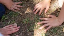
Collecting soil/sand samples for Lessons 6 and 8
Soil and sand are needed for students to construct model landscapes in Lesson 6, and for potential testing in Lesson 8.
If collecting soil and sand from a natural area, consider taking samples from different locations to minimise potential detrimental environmental impacts. Removing too much soil from any one location can expose tree roots, increase erosion, and harm animal habitats.
Potting mix might also be used as a source of soil, and sand can be purchased from hardware stores.
Safety considerations for soil/potting mix
Soil, mulch, compost and bagged potting mix are living products and can contain microbes, both helpful and potentially harmful. Of particular concern is Legionella bacteria.
It is important that any bagged product is opened and poured out in well-ventilated spaces, away from students. Open bags slowly with a pair of scissors, and away from the direction of your face.
Teachers and students should wear a mask and gloves when handling soil, mulch, compost and potting mixes. You should always wash your hands carefully after touching soil, particularly before eating and drinking.
What cross-curricula opportunities exist?
- This sequence could be taught along-side a literacy sequence to develop informative written (AC9E5LY06) or spoken (AC9E5LY07) texts.
- The erosion control strategy could also link with the maths curriculum by planning and conducting a statistical investigation (AC9M5ST03).
- The design and technology requirements of an erosion strategy provide an ideal opportunity to stretch the investigation and address multiple outcomes (AC9TDE6K05 AC9TDE6P01 AC9TDE6P02 AC9TDE6P03 AC9TDE6P04 AC9TDE6P05)
- The study of Australian landscape features through this sequence may be used as inspiration for the Arts subjects.
What incursions & excursions can be incorporated into this sequence?
- At school, participate in the Community DustWatch citizen science program.
- Invite a First Nations guest to share local knowledge about Caring for Country and how soil resources are preserved for future generations.
- Visit an old cemetery and observe and measure the weathering of head stones/grave stones made from various rock types.
- Take a guided tour through a cave or gorge to observe the formations made by weathering and erosion.
- Visit a mine or construction site to learn about the role of humans in weathering and erosion, the importance of raw materials, and sediment and erosion control measures used on the site.
The materials required for each lesson are listed on the lesson's page. For the full sequence resource list, download the Preparing to teach this sequence document below.

'Wear on Earth' is one of our new teaching sequences for AC V9
- On the 'Sequence overview' tab you'll find all the lessons in this sequence and curriculum alignment.
- The 'Our design decisions' tab shows how key scientific ideas develop over the sequence, and shows how the sequence addresses curriculum achievement standards.
- The 'Preparing for this sequence' tab guides you through important information and considerations for this sequence.
- Have you taught this sequence? Use the Feedback button to let us know how it went!